Soils Maps of Scotland
To celebrate World Soils Day on the 5th December and the start of the International Year of Soils, we have made available for download scanned copies of the original seven 1:250,000 scale soil maps of Scotland and the accompanying handbooks. The maps have been scanned in exactly the same format as the maps published in 1982 but rest assured, they still represent the diverse range of soils in Scotland. Not only are they excellent for educational purposes but they are also a small piece of history representing the completion of the National soil map of Scotland!
Each of the seven maps can be accessed from either the whole soil map of Scotland by selecting the area of interest and downloading a PDF version (low resolution) or a higher resolution from the table (below). The handbooks can be viewed by going to the table at the end of the page (or click here). Please be aware that use of the maps is covered by the Public Sector Geospatial Agreement.

Downloading data
To aid in the delivery of the soils data to our users we have made the following data available for download, these are available from the following page [1].
Soil Maps
The 1:250,000 National Soil Map of Scotland digital dataset is adapted from the 1:250,000 scale soil map series, itself derived from a mixture of new soil survey work undertaken between 1978 and 1981 and a simplification of more detailed soil mapping undertaken between 1947 and 1978. The National soil Survey Handbooks (published in the 1980s) provide a full description of the soil maps as published.
The 1:25,000 Soil Map of Scotland (partial cover) provisional dataset is derived from maps produced by soil surveys from 1947 through to 1987. These were published as 1:63,360 scale soil maps. The digital version is being corrected for errors and mismatches in the original data. A phased release of the corrected digital data started in 2014 and has been completed by September 2020 along with the addition of areas not previously diitised. The dataset can be downloaded here [2].
In addition, major revisions to the soil classification were made in October 2013 which affect all scale digital datasets. The revised classification can be viewed on the Soil classification [3] page.
Soil Maps of Scotland at 1:250,000 scale
View an on-screen image of each map by using the thumbnails in the table. High resolution copies suitable for printing can be downloaded (as pdf documents) from the links in the table. Please contact us at soils@hutton.ac.uk [4] if you wish 1:250,000 soil maps of a higher resolution suitable for a larger print size.
| Area covered | Approximate print size of file to download | ||
|---|---|---|---|
| A4 | Full size | ||
 [5] [5]Orkney and Shetland |
Orkney and Shetland [6] | Orkney and Shetland [7] | |
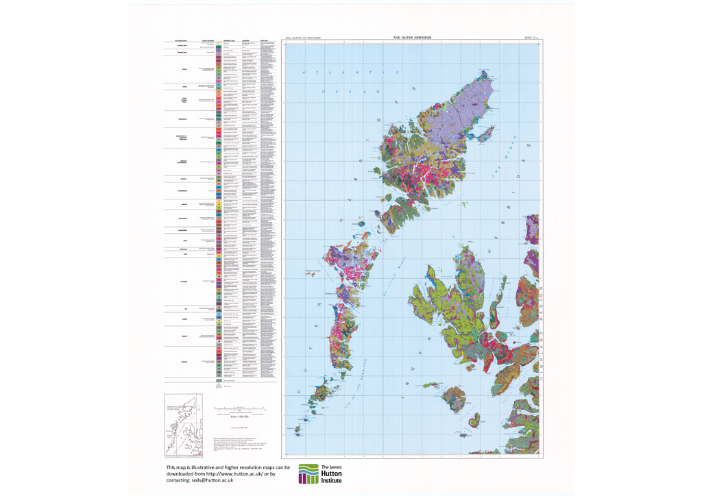 [8] [8]The Outer Hebrides |
The Outer Hebrides [9] | The Outer Hebrides [10] | |
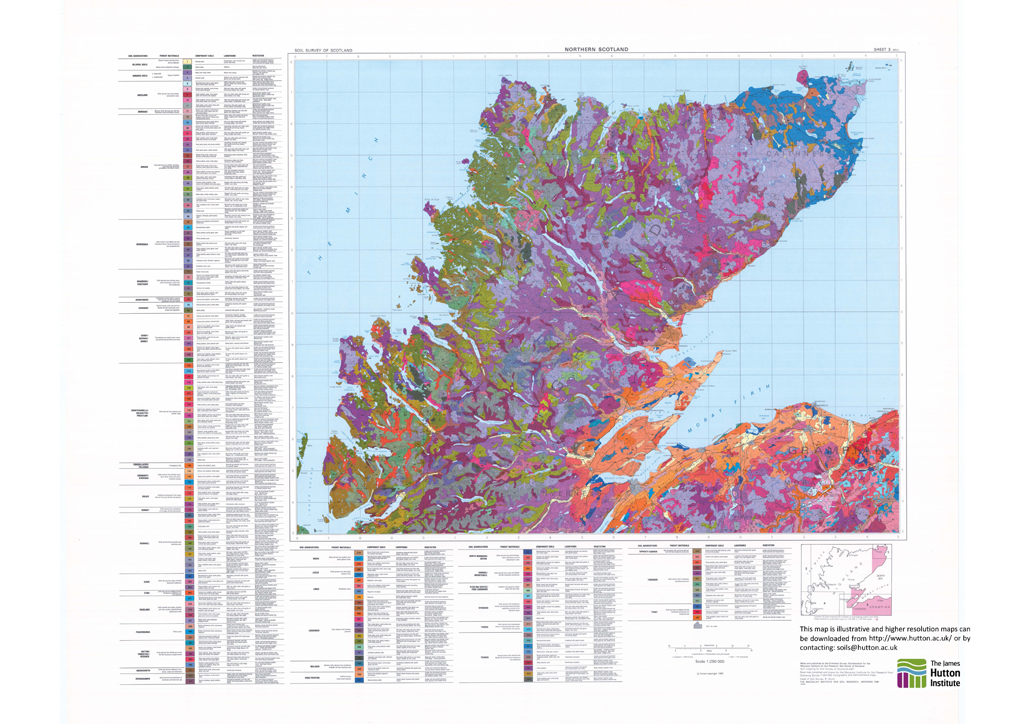 [11] [11]Northern Scotland |
Northern Scotland [12] | Northern Scotland [13] | |
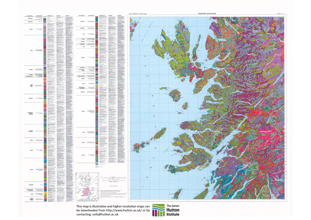 [14] [14]Western Scotland |
Western Scotland [15] | Western Scotland [16] | |
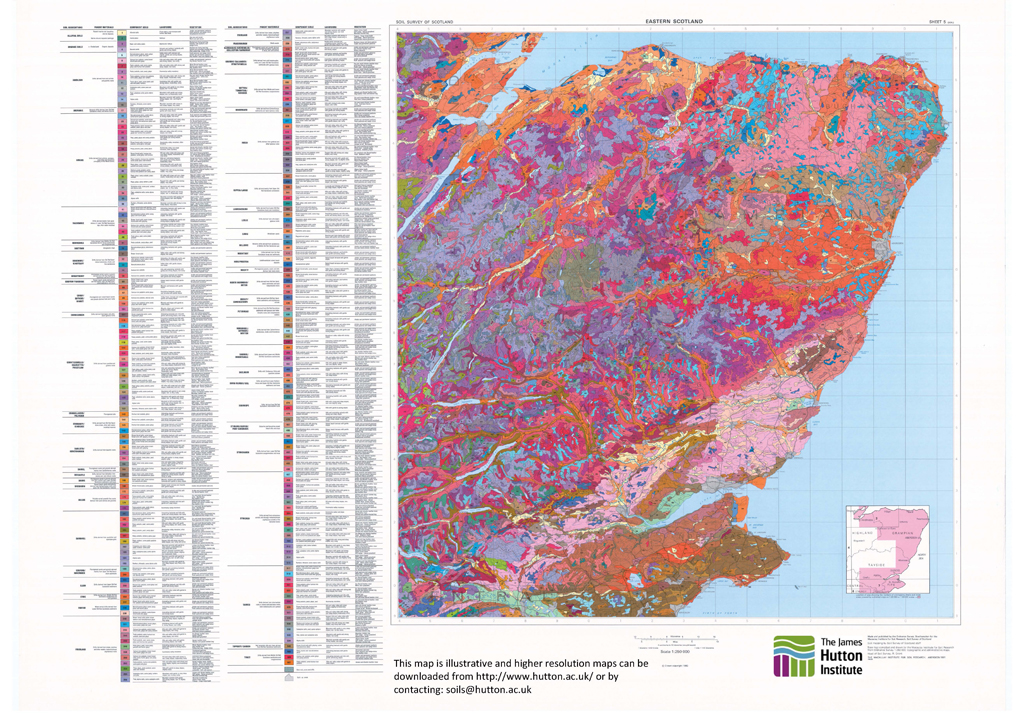 [17] [17]Eastern Scotland |
Eastern Scotland [18] | Eastern Scotland [19] | |
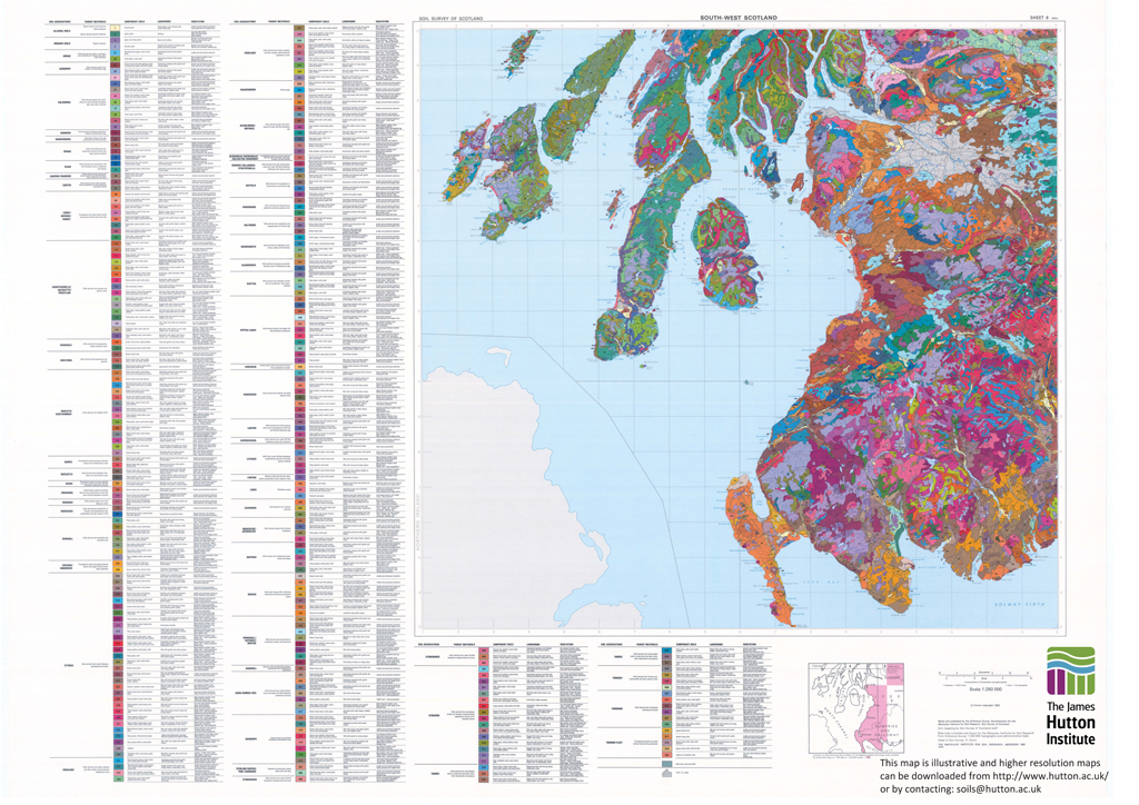 [20] [20]South West Scotland |
South West Scotland [21] | South West Scotland [22] | |
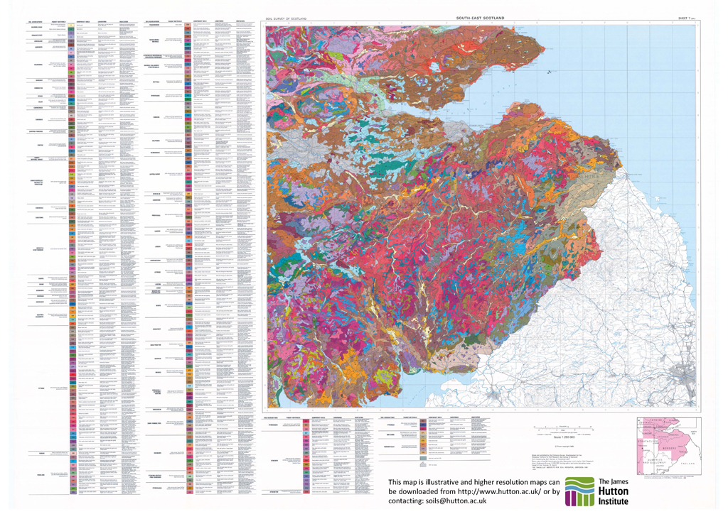 [23] [23]South East Scotland |
South East Scotland [24] | South East Scotland [25] | |
Memoirs of the 1:250,000 scale Soils of Scotland maps (Soils Handbooks)
Description of the 1:250,000 scale soil maps, use the image of the handbook to download a PDF copy.
 [26] [26]Orkney and Shetland |
 [27] [27]The Outer Hebrides |
 [28] [28]Northern Scotland |
 [29] [29]Western Scotland |
 [30] [30]Eastern Scotland |
 [31] [31]South West Scotland |
 [32] [32]South East Scotland |
 [33] [33]Organization and Methods |
Details on most of Scotland soil series are available in the Soil memoirs of the 1:63,360 soil maps for Scotland (see detail below) and some have been summarised in the Soil Map Unit Description Sheets. Due to the large number of soil series, these data files have been grouped in zip files A-C, D-F, G-K etc. Please download the appropriate zip file and extract the soil series you require - PDF reader is required.
- Soil series - A to C [34] (8.8 Mb, ZIP file)
- Soil series - D to F [35] (6.0 Mb, ZIP file)
- Soil series - G to K [36] (5.4 Mb, ZIP file)
- Soil series - L to O [37] (5.8 Mb, ZIP file)
- Soil series - P to Z [38] (8,4 Mb, ZIP file)
Memoirs of the 1:63,360 scale soil maps
- The Soils around Glasgow and The Firth of Clyde [39] (1988) (1.3 Mb)
- The Soils in Easter Ross [40] (1984) (962 KB)
- The Soils of Blairgowrie District [41] (1986) (1.2 Mb)
- The Soils of Caithness [42] (1986) (1.8 Mb)
- The Soils of Orkney 1985 [43] and 2016 [44] (1.3 Mb)
- The Soils of the Black Isle [45] (1984) (9.3 Mb)
- The Soils of the country round Banff, Huntly & Turriff [46] (1954) (16.8 Mb)
- The Soils of the country round Elgin - Interim Memoir [47] (1960) (6.1 Mb)
- The Soils round Jedburgh and Morebattle [48] (1956) (19.7 Mb)
- The Soils round Kelso & Lauder [49] (1960) (18.9 Mb)
- The Soils of Carrick and the Country round Girvan [50] (1973) (51.3 Mb)
- The Soils of the country Haddington and Eyemouth [51] (1967) (27.8 Mb)
- The Soils of the Country round Kilmarnock [52] (1956) (21.6 Mb)
- The Soils of the country round Stranraer and Wigtown [53] (1979) (36,2 Mb)
- The Soils of the country round Wick [54] (1977) (48.7 Mb KB)
- The Soils round Aberdeen, Inverurie and Fraserburgh [55] (1963) (37.3 Mb)
- The Soils round Perth, Arbroath and Dundee [56] (1976) (23.2 Mb)
- The Soils of Orkney 1985 [43] and 2016 [44] (1.3 Mb)
- The Soils of the Country round Fife and Kinross [57] (2016) (3.16 Mb)
- The Soils of the Country round Banchory, Stonehaven and Forfar [58] (2016) (3.94 Mb)
World Reference Base (WRB)
- Harmonisation of 1:250,000 map and soil profile – Scotland, Northern Ireland and Eire - Case Report (2008) [59] (1.2 Mb)
Land Capability for Agriculture (LCA)
The Land Capability Classification for Agriculture uses the physical characteristics of the land (including its soil, climate, topography and relief) to determine what crops it should be able to grow and how well it should be able to grow them. There are seven classes, class 1 being land capable of producing a wide variety of crops and class 7 being land of very limited agricultural value. Further infromation on the LCA is available [60].
Land Capability for Forestry (LCF)
The Land Capability Classification for Forestry is based on an assessment of the increasing degree of limitation imposed by the physical factors of soil, topography and climate on the growth of trees and on silvicultural practices. The system described is designed for use at several levels depending on the amount and accuracy of the available data and on the purpose for which the information is required. The main use of the Land Capability Classification for Forestry is as an aid to decision-making at broad planning levels, as a guide for land managers and as a statement of the natural resources of the land of Britain in terms of forestry potential for educational and general interest purposes. The system is an interpretation derived from several sources and, as with all such approaches, will be subject to some degree of arbitrary decision. Further information on the LCF is available [61].
Mapping Scotland's Soil Resources
The background to the development of the soils resouces is outlined in an excerpt [62] from the Society of Cartographers Bulletin published in 2015.
Ordnance Survey end-user licencing
The Ordnance Survey Public Sector (Scotland) End User Licencing agreement can be downloaded here:
 [63]
[63]
PDF file: Ordnance Survey Public Sector (Scotland) End User Licence [64] (41 KB)
Links:
[1] https://www.hutton.ac.uk/research/themes/safeguarding-natural-capital/soilshutton/soils-maps-scotland/download
[2] https://www.hutton.ac.uk/research/themes/safeguarding-natural-capital/soilshutton/soils-maps-scotland/download#soilmapdata)’
[3] https://www.hutton.ac.uk/research/themes/safeguarding-natural-capital/soilshutton/soil-classification
[4] mailto:soils@hutton.ac.uk?subject=Enquiry%20from%20Soils%40Hutton%20soil%20maps%20webpage
[5] https://www.hutton.ac.uk/sites/default/files/images/yearofsoil/Soil250k_orkney-and-shetland-1024px.jpg
[6] https://www.hutton.ac.uk/sites/default/files/files/soils/Soil250k_1_Orkney_and_Shetland_A4.pdf
[7] https://www.hutton.ac.uk/sites/default/files/files/soils/Soil250k_1_Orkney_and_Shetland_full.pdf
[8] https://www.hutton.ac.uk/sites/default/files/images/yearofsoil/Soil250k_the-outer-hebrides-1024px.jpg
[9] https://www.hutton.ac.uk/sites/default/files/files/soils/Soil250k_2_Outer_Hebrides_A4.pdf
[10] https://www.hutton.ac.uk/sites/default/files/files/soils/Soil250k_2_Outer_Hebrides_full.pdf
[11] https://www.hutton.ac.uk/sites/default/files/images/yearofsoil/Soil250k_northern-scotland-1024px.jpg
[12] https://www.hutton.ac.uk/sites/default/files/files/soils/Soil250k_3_Northern_Scotland_A4.pdf
[13] https://www.hutton.ac.uk/sites/default/files/files/soils/Soil250k_3_Northern_Scotland_full.pdf
[14] https://www.hutton.ac.uk/sites/default/files/images/yearofsoil/Soil250k_western-scotland-1024px.jpg
[15] https://www.hutton.ac.uk/sites/default/files/files/soils/Soil250k_4_Western_Scotland_A4.pdf
[16] https://www.hutton.ac.uk/sites/default/files/files/soils/Soil250k_4_Western_Scotland_full.pdf
[17] https://www.hutton.ac.uk/sites/default/files/images/yearofsoil/Soil250k_eastern-scotland-1024px.jpg
[18] https://www.hutton.ac.uk/sites/default/files/files/soils/Soil250k_5_Eastern_Scotland_A4.pdf
[19] https://www.hutton.ac.uk/sites/default/files/files/soils/Soil250k_5_Eastern_Scotland_full.pdf
[20] https://www.hutton.ac.uk/sites/default/files/images/yearofsoil/Soil250k_south-west-scotland-1024px.jpg
[21] https://www.hutton.ac.uk/sites/default/files/files/soils/Soil250k_6_South_West_Scotland_A4.pdf
[22] https://www.hutton.ac.uk/sites/default/files/files/soils/Soil250k_6_South_West_Scotland_full.pdf
[23] https://www.hutton.ac.uk/sites/default/files/images/yearofsoil/Soil250k_south-eastern-scotland-1024px.jpg
[24] https://www.hutton.ac.uk/sites/default/files/files/soils/Soil250k_7_South_East_Scotland_A4.pdf
[25] https://www.hutton.ac.uk/sites/default/files/files/soils/Soil250k_7_South_East_Scotland_full.pdf
[26] https://www.hutton.ac.uk/sites/default/files/files/soils/39-orkney-and-shetland-sheet-one.pdf
[27] https://www.hutton.ac.uk/sites/default/files/files/soils/40 - the outer hebrides sheet two.PDF
[28] https://www.hutton.ac.uk/sites/default/files/files/soils/41 - northern scotland sheet three.pdf
[29] https://www.hutton.ac.uk/sites/default/files/files/soils/42 - western scotland sheet four.pdf
[30] https://www.hutton.ac.uk/sites/default/files/files/soils/43 - eastern scotland sheet five.pdf
[31] https://www.hutton.ac.uk/sites/default/files/files/soils/44 - south west scotland sheet six.pdf
[32] https://www.hutton.ac.uk/sites/default/files/files/soils/45 - south east scotland sheet seven.pdf
[33] https://www.hutton.ac.uk/sites/default/files/files/soils/46 - SOIL SURVEY OF SCOTLAND HANDBOOK 8.PDF
[34] https://www.hutton.ac.uk/sites/default/files/files/soils/162141013_A-C.zip
[35] https://www.hutton.ac.uk/sites/default/files/files/soils/162141013_D-F.zip
[36] https://www.hutton.ac.uk/sites/default/files/files/soils/162141013_G-K.zip
[37] https://www.hutton.ac.uk/sites/default/files/files/soils/162141013_L-O.zip
[38] https://www.hutton.ac.uk/sites/default/files/files/soils/162141013_P-Z.zip
[39] https://www.hutton.ac.uk/sites/default/files/files/soils/142141013_THE_SOILS_AROUND_GLASGOW_AND_THE_FIRTH_OF_CLYDE.PDF
[40] https://www.hutton.ac.uk/sites/default/files/files/soils/142141006_THE_SOILS_IN_EASTER_ROSS.PDF
[41] https://www.hutton.ac.uk/sites/default/files/files/soils/142141013_THE_SOILS_OF_BLAIRGOWRIE_DISTRICT.PDF
[42] https://www.hutton.ac.uk/sites/default/files/files/soils/142141013_THE_SOILS_OF_CAITHNESS.PDF
[43] https://www.hutton.ac.uk/sites/default/files/files/soils/142141013_THE_SOILS_OF_ORKNEY.PDF
[44] https://www.hutton.ac.uk/sites/default/files/files/soils/Orkney_Soil_Memoir_2016.pdf
[45] https://www.hutton.ac.uk/sites/default/files/files/soils/142141013_THE_SOILS_OF_THE_BLACK_ISLE.PDF
[46] https://www.hutton.ac.uk/sites/default/files/files/soils/142141013_THE_SOILS_OF_THE_COUNTRY_ROUND_BANFF_HUNTLY_&_TURRIFF-FIELD_BOOK_6.PDF
[47] https://www.hutton.ac.uk/sites/default/files/files/soils/142141013_THE_SOILS_OF_THE_COUNTRY_ROUND_ELGIN-INTERIM_MEMOIR.PDF
[48] https://www.hutton.ac.uk/sites/default/files/files/soils/142141013_THE_SOILS_ROUND_JEDBURGH_AND_MOREBATTLE.PDF
[49] https://www.hutton.ac.uk/sites/default/files/files/soils/142141013_THE_SOILS_ROUND_KELSO_&_LAUDER.PDF
[50] https://www.hutton.ac.uk/sites/default/files/files/soils/142141013_THE_SOILS_OF_CARRICK_AND_THE_COUNTRY_ROUND_GIRVAN.PDF
[51] https://www.hutton.ac.uk/sites/default/files/files/soils/142141013_THE_SOILS_OF_THE_COUNTRY_HADDINGTON_AND_EYEMOUTH.PDF
[52] https://www.hutton.ac.uk/sites/default/files/files/soils/142141013_THE_SOILS_OF_THE_COUNTRY_ROUND_KILMARNOCK.PDF
[53] https://www.hutton.ac.uk/sites/default/files/files/soils/142141013_THE_SOILS_OF_THE_COUNTRY_ROUND_STRANRAER_AND_WIGTOWN.PDF
[54] https://www.hutton.ac.uk/sites/default/files/files/soils/142141013_THE_SOILS_OF_THE_COUNTRY_ROUND_WICK.PDF
[55] https://www.hutton.ac.uk/sites/default/files/files/soils/142141013_THE_SOILS_ROUND_ABERDEEN_INVERURIE_AND_FRASERBURGH.PDF
[56] https://www.hutton.ac.uk/sites/default/files/files/soils/142141013_THE_SOILS_ROUND_PERTH_ARBROATH_AND_DUNDEE.PDF
[57] https://www.hutton.ac.uk/sites/default/files/files/soils/Fife_and_Kinross_Soil_Memoir.pdf
[58] https://www.hutton.ac.uk/sites/default/files/files/soils/Banchory_Stonehaven_and_Forfar_Soil_Memoir.pdf
[59] https://www.hutton.ac.uk/sites/default/files/files/soils/175141216_GS_SOIL_Scotland_Ireland_soilmap.pdf
[60] https://www.hutton.ac.uk/research/themes/realising-lands-potential/natural-resource-datasets-and-databases/lca
[61] https://www.hutton.ac.uk/research/themes/realising-lands-potential/natural-resource-datasets-and-databases/lcf
[62] https://www.hutton.ac.uk/sites/default/files/files/soils/183151002_Mapping_Scotlands_Soil_Resources.pdf
[63] https://www.hutton.ac.uk/sites/default/files/files/Ordnance Survey Public Sector (Scotland) End User License.pdf
[64] https://www.hutton.ac.uk/sites/default/files/files/Ordnance Survey Public Sector (Scotland) End User License(2).pdf
[65] https://www.hutton.ac.uk/staff/allan-lilly
[66] https://www.hutton.ac.uk/staff/david-donnelly
[67] https://www.hutton.ac.uk/staff/helaina-black
[68] https://www.hutton.ac.uk/staff/margaret-mckeen
[69] https://www.hutton.ac.uk/staff/malcolm-coull
[70] https://www.hutton.ac.uk/about/facilities/national-soils-archive
[71] https://www.hutton.ac.uk/learning/natural-resource-datasets/soilshutton/soils-maps-scotland/download
[72] https://www.hutton.ac.uk/learning/soilshutton/soil-classification
[73] https://www.hutton.ac.uk/learning/natural-resource-datasets/landcover/land-capability-agriculture
[74] https://www.hutton.ac.uk/learning/natural-resource-datasets/landcover/land-capability-forestry