Published on The James Hutton Institute (https://www.hutton.ac.uk)
Peat Surveys: Mindork Moss
Peat Deposit: Mindork Moss, Wigtownshire
| Identifier | Name | Survey Year | Total Area (>0.5m depth) | Total Volume (m3) | Max. Depth (m) | Mean Depth (m) |
|---|---|---|---|---|---|---|
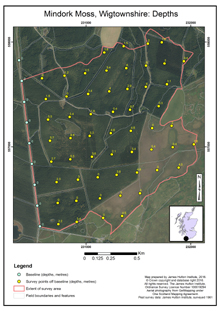
| 41 | Mindork Moss [3] | 1961 | 182 | 6,290,000 | 6.8 | 3.5 |
Footnotes:
- Interpolated values from field observations
- All peat area surveyed, not only that greater than 0.5m
Notes:
Identifier:
- 1 to 70: Scottish Peat Committee Moss Survey report number
- 71 to 122: Macaulay Institute for Soil Research survey number
Name:
- Name of peat deposit or bog
Survey year:
- Year of survey published, if known. U/K not recorded on map.
Total Area (ha) (>0.5 m depth):
- Area to nearest ha, of peat greater than 0.5 m. For full topographic surveys, the area can be calculated
Total Volume (m3):
- Volume of peat for areas greater than 0.5m deep. For full topographic surveys, the volume can be calculated
Max. Depth (m):
- Maximum measured depth, unless otherwise stated
Mean depth (m):
- Mean depth of areas greater than 0.5 m deep.
Collated from survey data records, by:
- David Miller [4] – formerly surveyor, Peat and Forest Soils, Macaulay Institute for Soil Research and Macaulay Land Use Research Institute, currently Knowledge Exchange Coordinator, James Hutton Institute [5]
- Allan Robertson – formerly Head of Department, Peat and Forest Soils, Macaulay Institute for Soil Research
- John Bell – soil surveyor, Soil Survey of Scotland, Macaulay Institute for Soil Research, and peat surveys, Macaulay Land Use Research Institute
- James Anderson - formerly of the Peat Section, Peat and Forest Soils, Macaulay Institute for Soil Research
- Jane Morrice - formerly of Peat and Forest Soils, Macaulay Institute for Soil Research, and Macaulay Land Use Research Institute, formerly research scientist, James Hutton Institute
Source URL (retrieved on 2024-04-20 08:37): https://www.hutton.ac.uk/node/14329
Links:
[1] https://www.hutton.ac.uk/sites/default/files/files/Mindork Moss_Points and labels.jpg
[2] https://www.hutton.ac.uk/sites/default/files/files/Mindork Moss_Depths_2.jpg
[3] http://www.hutton.ac.uk/sites/default/files/files/Mindork%20Moss_Depths.jpg
[4] https://www.hutton.ac.uk/staff/david-miller
[5] https://www.hutton.ac.uk/
[6] https://www.hutton.ac.uk/learning/natural-resource-datasets
[7] https://www.hutton.ac.uk/learning/natural-resource-datasets/peat-surveys/peat-deposits

